Empowering Growth with
Next-Gen Technology
I am a Website Developer|
Providing world-class Software & Mobile App Development, Artificial Intelligence Solutions, Professional Graphic Design, Expert DJI Drone Surveying, CCTV Security setups, and Strategic Business Consulting.
Projects Completed
Happy Clients
Years of Experience
Skills Mastered

Educational Foundation
My academic background that shaped my logical structure, critical thinking, and enterprise analysis skills.
Middle School Bakht Bilanda
Bakht Bilanda Village
Constructed the root foundations of logic, mathematics, and science, developing an early passion for learning and engineering. Represented a high-achieving start in childhood academics.
Matriculation (Science)
Khadagzai Village
Completed matriculation in Science subjects with high standing. Built a core analytical mindset studying basic physics, chemistry, biology, and advanced mathematics.
FA / Intermediate
Minabrangola College
Studied humanities, economics, and language structures. Enhanced social and analytical thinking capacities, polishing communication in Urdu and English alongside technical study.
Master's Degree
University of Malakand
Earned a Master of Arts degree, developing advanced research capabilities, strategic communication, organizational behavior knowledge, and analytical evaluation skills critical for enterprise consulting.
Professional & Enterprise Services
Delivering world-class digital services, IT support, and technological solutions to scale businesses worldwide.
Website Development
Fully custom, responsive, and performance-optimized websites tailored to your enterprise needs.
- Modern Single Page Apps (SPA)
- E-commerce Solutions (WooCommerce)
- CMS Development (WordPress/PHP)
Application Development
High-performance cross-platform mobile apps for Android and iOS devices.
- Cross-platform mobile codebases
- Premium interactive UI layouts
- Core system API integrations
Software Development
Bespoke desktop systems, script automations, and custom database operations.
- Command line automation scripts
- High-performance DB structures
- Multi-threaded system design
Python Development
Robust backend development, web scraping engines, and data pipeline integrations.
- Django & Flask web apps
- Highly scalable scraper systems
- CSV, JSON, and database pipelines
AI & Machine Learning Solutions
Integrating smart LLMs, data analytics models, and robotic AI pipelines into workflows.
- API-driven LLM chatbots
- Machine learning forecasting tools
- Smart OCR & data parsing solutions
Graphics Designing
Premium corporate branding, vectors, flyers, brochures, and visual art files.
- Vector editing & logo designs
- High-res promotional brochures
- CorelDRAW, Illustrator, & Photoshop
Video Editing
Professional video production, color grading, transitions, and social edits.
- Adobe Premiere Pro workflow
- High-definition drone reel editing
- Audio balancing & color adjustment
DJI Drone Training
Professional operator training for drone flight, safety parameters, and software mission control.
- Drone flight school certifications
- Flight safety and regulations
- Real-world manual piloting drills
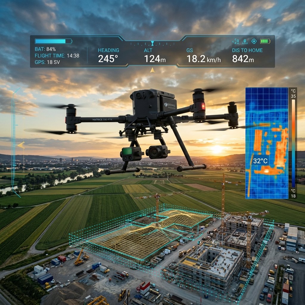
Drone Operations & Mapping
Autonomous mapping, land surveying, and thermal camera investigations using DJI platforms.
- 2D Orthomosaic generation
- 3D Elevation mapping scans
- Professional thermal inspection
Google Business Profile (GBP)
Setting up, listing, optimizing, and verified scaling of Google Local Map records.
- GBP setup and verification
- Local SEO maps keyword boost
- Client review ranking strategies
SEO & Digital Marketing
Strategic search engine rankings, lead generation, and social media advertising campaigns.
- Detailed technical page SEO
- Facebook, Instagram & Google Ads
- Content and conversion strategies
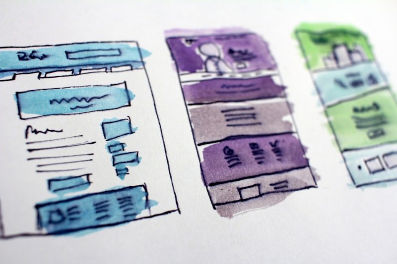
Figma UI/UX & Canva Design
High-fidelity user interface prototyping, web wireframing, and quick graphic assets.
- Figma wireframes & flow charts
- UI/UX interactive client mockups
- High-conversion Canva templates
CCTV Security Installation
End-to-end IP and analog camera installation, configuring DVR/NVR recorders, and line repairs.
- HD IP and analog cameras setup
- DVR/NVR remote network view
- Security structural wire runs
Hardware & Networking
Troubleshooting computers, diagnosing networks, structural cable layouts, and hardware diagnostics.
- PC assembly and component diagnostics
- LAN cabling & Wi-Fi router configurations
- Server racks & switch installations
Mobile Repairing
Hardware repair, LCD replacements, software flashing, and component diagnostics for smartphones.
- Hardware troubleshooting
- Screen replacements
- Flashing firmware
Data Entry & Office Support
High-speed data compiling in Microsoft Office tools with multi-language typing support.
- Rapid English & Urdu word processing
- Advanced Excel sheet scripting
- Clean document styling
DJI Drone Specialization
Providing state-of-the-art UAV flight operations, advanced sensor configuration, thermal mapping, and professional pilot instructor lessons.
DJI Mavic & Mini Series
Used for high-resolution 4K aerial photography, video production, real estate reels, and low-altitude visual mapping operations.
DJI Matrice & Enterprise Series
Utilized for industrial utility surveys, power grid inspections, agricultural analytics, search and rescue, and thermal scans.
Featured Projects Gallery
Explore projects across different domains, highlighting technical quality, execution speed, and high visual standard.


Gul Rasool Khan Digital Agency
Malakand Region, Khyber Pakhtunkhwa, Pakistan
Proudly serving domestic and international clients with technology training, web deployment, graphic designing, and drone surveying services. Offering optimized solutions to get businesses discovered locally and globally.
Client Success Stories
Hear from businesses, agricultural firms, and students who have scaled their operations using my technical consulting.
Technical Skills Matrix
Visual breakdown of proficiency levels across primary coding languages, drone operating tools, and design software suites.
Software, Development & AI
Drone, Hardware & Creative Systems
Start a Project Together
Ready to scale your business operations or start flight planning? Contact me directly or submit the secure form below.
Connect Instantly
For urgent consulting, DJI mapping projects, or development updates, reach out via call or messaging apps below.